Our Story
The next great discovery may sitting on your hard drive. Inspired by the story of the lost Antikythira mechanism, we founded Kythira Labs to help your research project make a big splash rather than getting lost at sea.
With our web development, advanced data analytics, and digital map-making expertise, we can help you unlock hidden insights from your datasets and share your findings with key stakeholders and the general public. We can either work with data you aleady have or help you design a compelling public communciations and data transparency component to your next research grant. Book a free consultation with us today to find out how we can bring your next project to life.
The Minds Behind Kythira
Ben Woodward
Co-Founder
Ben is an MSc candidate with a broad set of expertise in geomorphology, 3D modelling, transportation geography, and digital humanities. Ben previously worked as a developer with Esri Canada's Education and Research team, and is proficient in both Esri and open source mapping technology. As Canada's first ever gold medallist at the International Geography Olympiad, Ben not only has advanced digital mapmaking skills, but also the subject matter knowledge required to tailor your digital project to your research topic.

Josh Muszka
Co-Founder
Josh is an experienced software developer with a technical focus on meteorological research and real-time data pipelines. Working with the Northern Mesonet Project, an initiative of the Canadian Severe Storms Laboratory, Josh engineers applications at scale and manages the complex data requirements of real-time digital maps. By integrating his domain knowledge with expertise in data science and applied AI, he builds the technical infrastructure and models required to transform massive datasets into functional digital realities.
Our Work
A selection of our custom-tailored dashboards and research tools.
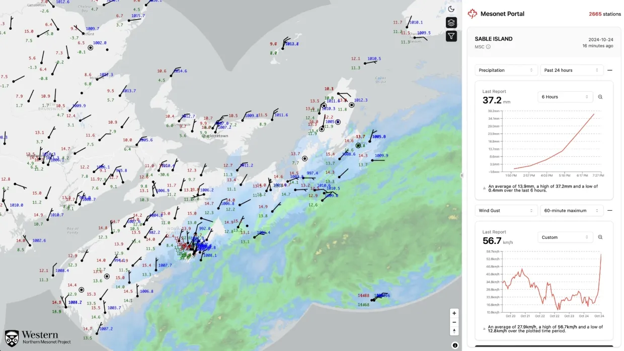
Canadian Mesonet Portal
Authors: Josh Muszka, Canadian Severe Storms Laboratory
The Canadian Mesonet Portal is a central repository and access point for publicly available surface weather observations across Canada. This includes specialized high-density networks installed and maintained by the CSSL for the dual purpose of evaluating new techniques and technologies as well as capturing weather events in high time resolution in underserviced areas prone to severe convective storms.
View Project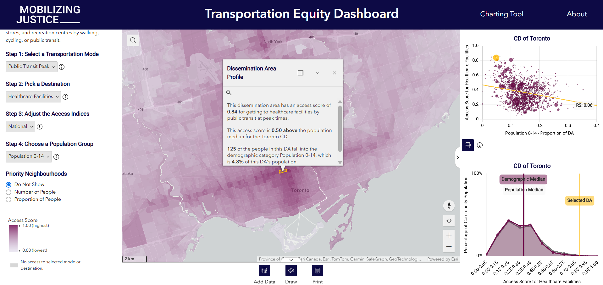
Transportation Equity Dashboard
Authors: Ben Woodward, Mobilizing Justice, Esri Canada Education and Research
The Mobilizing Justice Transportation Equity Dashboard pairs advanced access-to-service analytics with DA-level census data to understand structural inequities in Canada's transportation infrastructure at a neighbourhood level.
View Project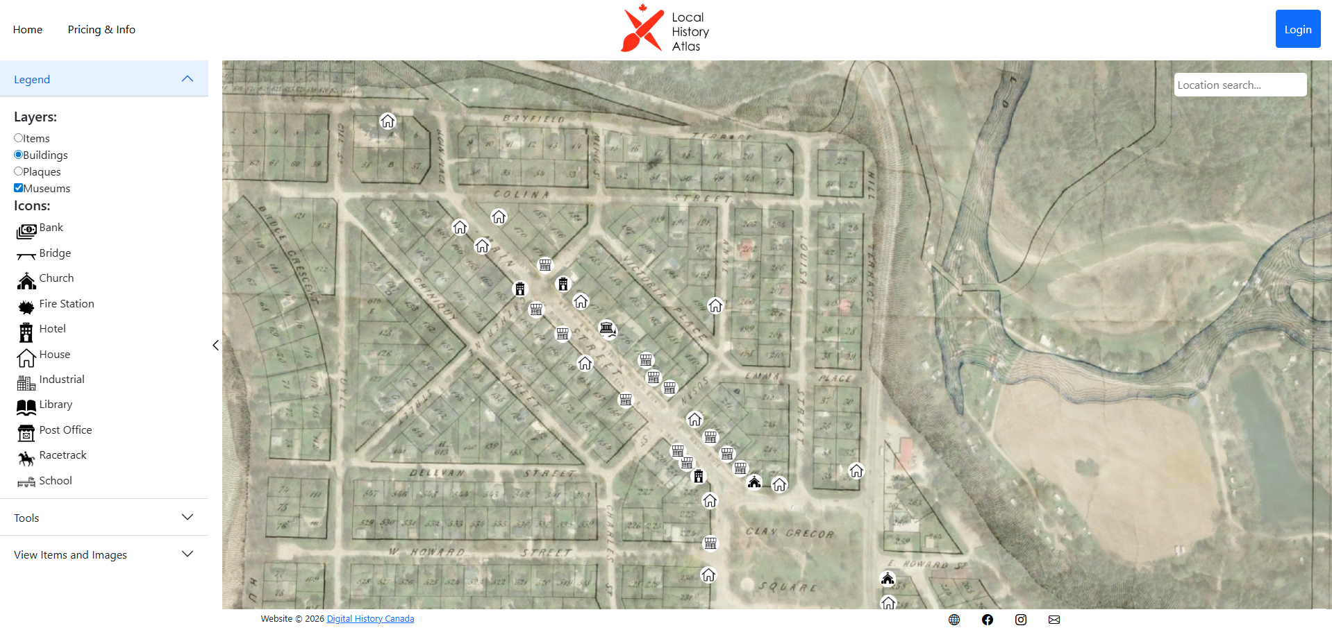
Local History Atlas & AR
Authors: Ben Woodward
The Local History Atlas & AR project combines historical data with location-based augmented reality to create immersive experiences for exploring Canada's local history and heritage without the need for putting up markers or installing an app.
View ProjectA Brief History
The story that inspired us to create Kythira Labs.
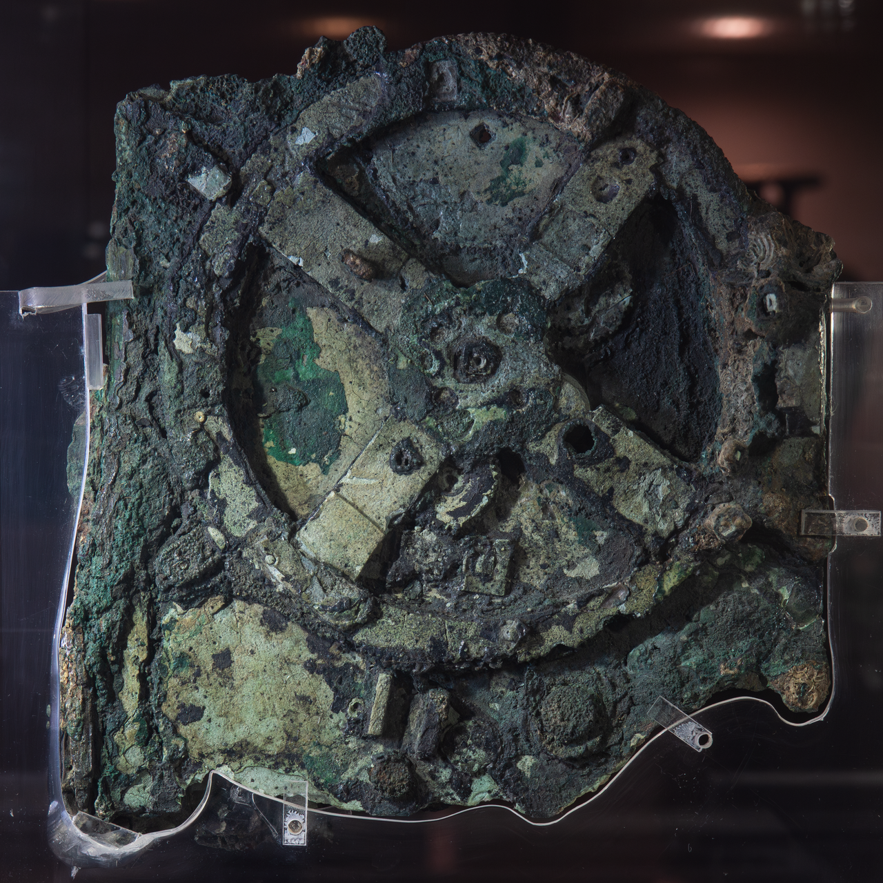
Discovered in 1901 among wreckage off the coast of the Greek island Antikythira, the lost mechanism dates back to the 2nd century BCE and is generally considered to be the oldest known computer. It consists of a complex system of over 30 bronze gears housed in a wooden case, which were used to predict astronomical positions, eclipses, and even the cycles of the ancient Olympic Games with extraordinary precision.
Today, the fragments are kept at the National Archaeological Museum in Athens, where they continue to be studied using X-ray imaging to uncover hidden inscriptions and internal workings.